The main fiesta of the municipality of Arucas is the fiesta of its Patron Saint, San Juan Bautista, which is celebrated every year on the 24th of June. The traditional San Juan bonfires are lit the night before, after organising a livestock fair and a pilgrimage in which men and women in typical costume dance to the rhythm of Canary Island folk music.

These religious and festive events also attract the local craftsmen, who exhibit a wide range of typical local products to the participants. The religious fiestas held in Arucas also include the Fiestas de Santa Lucia, the 13th of December, and the Fiestas de San Sebastian, the 20th of January.
The Carnival, in February, is the most important and popular recreational fiesta of the municipality and the Christmas Festivities in December also has an ample programme of popular events.
The first historical references to what used to be Arehuc or Arehucas, as the original Canary Island settlers called it, date back to some years before Gran Canaria was conquered and made part of the Crown of Castile in the late 15th century.

The original population was wiped out in the first incursion made by Juan Rejon in 1479. Two years later the famous native leader Doramas lost his life in the famous "Battle of Arucas", at the hands of Pedro de Vera, Juan Rejon’s successor.
The conquest of Gran Canaria was completed in 1483, and that same year, the conquistadors started to divide up the lands and water of the district of Arucas among the leaders, including: Tomas Rodriguez de Palenzuela, Juan de Ariñez, Lope de Sosa, Juan Siberio and Hernando de Santa Gadea.
The area’s favourable natural conditions and major water resources meant that sugar cane plantations were soon successful, which led to the construction of several sugar mills.
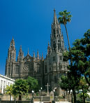
In 1503, Arucas was founded, when the first settlement was laid out around the former Church of San Juan. In 1515, this chapel was declared a Parish Church by Bishop Fernando Vazquez de Arce.
After 1572, the major landowners of Arucas, Don Pedro de Ceron and his wife Sofia de Santa Gadea created the Feudal Estate of Arucas, which was to set the socio-economic pattern of the municipality until the mid 19th century. This also coincided with the turn to cochineal in the island, as the only crop, starting a period of great economic prosperity and agricultural and urban development. In the second half of the 19th century, new lands were brought under the plough, and crops came and went with the different economic booms. Cochineal was followed by sugar cane (in its second cycle) and, to a lesser extent, tobacco. Sometime later, bananas were introduced, which reached the height of their expansion in the 19th century.
http://turismo2.grancanaria.com/
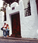
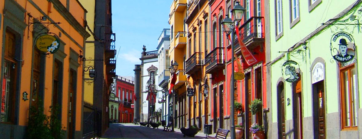
At the same time, and under the auspices of the Heredad de Aguas de Arucas y Firgas (Arucas and Firgas Water Rights Association), a highly complex network of canals, irrigation pipes, angle pipes and reservoirs was built. At the end of the 19th century, most of the architectural and urban transformations of the present Historic Quarter were carried out. In 1894, the Town of Arucas was granted the title of "Municipality of Arucas".
Farming, in the modality of single crop farming, up until recently has been the main support of the local economy: sugar cane in the 16th century; potatoes, maize, cereals, vines and vegetables in the 17th and 18th centuries; cochineal, sugar cane and tobacco in the 19th century and bananas in the 20th century.


Since the 70s, Arucas has always stood out as one of the leading banana growing municipalities of Gran Canaria.
This farming tradition continues with the industrial activity of the La Isleña Cocoa and Pastas Factory, the Bandama Biscuit factory, the Sugar Mill and the San Pedro Distillery (now Arehucas Distilleries.) The latter processes the sugar cane into rum.
Trade, services and tourism have also acquired certain importance in the municipality in recent years.
The Municipality of Arucas is situated on the north coast of Gran Canaria, covering a surface area of approximately 33.15 square kilometres, stretching from the coast up to the foothills at more than 600 metres above sea level.
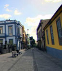
This is an area that has been heavily transformed by human activity, where the built up areas, farming fields and the different associated facilities (tanks, irrigation channels, terraces, etc.) to a large extent define the landscape that can be seen in the municipality.
The municipality of Arucas is about 12 kilometres from Las Palmas de Gran Canaria, and it is set on the southern slopes of the mountain of the same name. This is a rugged volcanic edifice, whose lavas reached the coast, forming a platform in the northern part that slopes gently down towards the sea.
The appearance of the volcano closed the former gullies and generated a bowl to the south, which has subsequently formed what is now known as the Vega de Arucas (Arucas Plain).
The terrain in the interior of the municipality is rugged and broken. The Lomo de Riquianez Ridge rises up on the eastern boundary of the municipality, the Lomo Jurgon Ridge in the centre, and the Lomo Tomas de Leon Ridge, on the western boundary.