This wooden cross has been a fixture here since time immemorial. The area is known as La Crucita as it is the name given to the surrounding village. It is a walkers’ crossroads as it marks the meeting point between the royal footpaths that join up from the centre of the island, Cruz de Tejeda and Las Arvejas, Barranco Hondo, Coruña and Las Cuevas.

The cross is on the Ruta de lo Sagrado, which goes back to aboriginal times, as the paths that cross here join the villages of Artevirgo, Risco Caído, the sanctuary of Risco Chapí and Cuevas de Caballero, plus the aboriginal settlements at Artenara and Guardaya and the prehispanic hamlets of Acusa. This rich cultural heritage makes this ethnological site a reference point both for hikers and tourists, who go along the dam route from the north down to the porcelain centre of Lugarejos.
La Crucita is an ethnographical icon with religious symbolism. It was traditionally a stop off point for funeral casks passing through, and a meeting point for countryfolk, farm workers and shepherds. They would stop here briefly to pay their respects, drop their farming tools, and say a prayer before carrying on with their farming work.


The carriers of the Rama, coming down from Tamadaba for the fiestas of Santo Domingo de Guzmán de Juncalillo, would also stop off here for an hour for a chat and a drink, and have a dance and a sing to get in the mood. On 2nd May, the neighbours from the district of Las Cuevas would wrap wild flowers around the Cross. On the eve of San Juan, marking the summer solstice, a large bonfire was set up right next to it, and since the end of last century, the parish priest of Artenara on the Saturday following the day of the Cross has celebrated evening mass here, congregating numerous neighbours from surrounding districts.
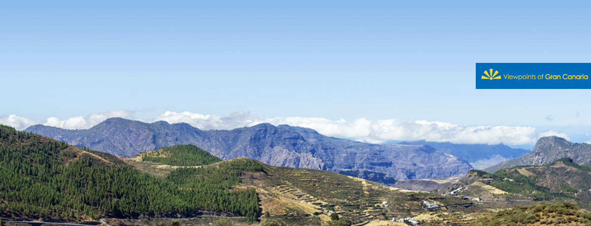
The views to be enjoyed from this spot cover the skyline over Roque Nublo, Montaña de la Cilla, El Brezo, Pinar de Tamadaba and the most recently emerging Parque de Otoño, in the area of Risco Caído. The surrounding land is typically dedicated to agriculture, although this is now sadly in decline.