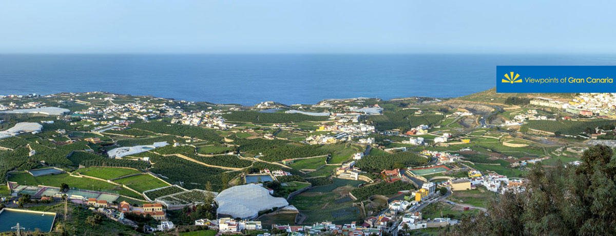
This viewpoint opens out over the coast of Arucas, between the districts of Tinocas and San Andrés, with other coastal towns scattered around in between, including Quintanilla, Bañaderos and El Puertillo. The coastal outline is winding and uneven, and goes on for around 14 kilometres. It is broken up by the mouths of several ravines. The coastline reaches heights of up to 100 metres above sea level, giving it a distinctly cliff-like appearance.
")
")
The economy in Arucas has been quite varied, starting with sugar cane cultivation (16th C), wine production (17th C), cereal, vegetable and fruit farming (18th C), sugar cane, tunera cactus plant (for suckling pig), tomato plants (mid to end of the 19th C), through to banana plantations (end of the 19th C and all through the 20th C). Its present day economy is based largely on the service sector, and to a lesser extent, banana cultivation and industrial production. The countryside all around is dominated by banana trees, many of them sitting beneath plastic protective covers.
From here we are also treated to stunning views over to the capital city, Las Palmas de Gran Canaria, featuring the isthmus of La Isleta, leading to the wonderful Las Canteras Beach, so called for its positioning on top of former stone quarries. This site makes for an excellent watch tower, providing splendid views all over the whole municipality, both inland and down to the coast. The highlights are the volcano of La Montaña de Cardones, and on clear days the peak of Mount Teide on the neighbouring island of Tenerife, for visitors to feast their eyes on.


