The main and oldest fiesta in the municipality is the Fiesta in honour of Santa Brígida, Patron Saint of the Municipality. There is a pilgrimage-offering that is organised for the first Saturday of August, and the tradition goes back to 1957. All the towns in the municipality take part with floats decorated with typical motifs and pilgrims, people in traditional country dress and street parties.
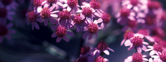
Then there is the Feast of San Antonio, celebrated on June 13, with a range of different events, but, above all, the FLORABRÍGIDA , an exhibition of flowers, plants and birds that has been held every year since 1975.
In the area of La Atalaya, they hold a festival to Honour San Pedro. This is a traditional fiesta that includes the Torch Parade (Romería de las Antorchas), in which the pilgrims carry the figure of the Saint out to the caves of the potters.
The Bajada al Velero (Descent to the Sailing Ship) is held at the end of August in the village of Las Meleguinas. The locals gather at the old wash houses to act out the activities of the laundry maids among the festivities.
And, on the eve of All Saints Day, they celebrate the Fiesta de los Finaos in the area of El Madroñal. The local inhabitants get together to chat and eat autumn fruit (chestnuts, local apples, wine and anis). This fiesta is also celebrated in town.
The municipality of Santa Brígida has changed its name on several occasions in the course of its history. Sataute, meaning "palm tree", was its aboriginal name. It has also been called: El Lugar de la Vega, La Vega, Vega de Abajo, Vega de San Antonio and, finally, Santa Brígida or Villa de Santa Brígida.
The Canary Island aborigines survived in the area, using the forest as their means of subsistence, gathering fire wood for their pottery kilns and their cooking fires, and wood for their tools and utensils. All of this can be seen from the archaeological remains to be found at sites in the area, such as La Atalaya and Cueva de los Canarios.
La Villa de Santa Brígida, became part of Canary Island history as it was the capital and general military headquarters of the island for a week, the time it took to defeat and expel the Dutch army led by Admiral Pieter Van Der Does.
Santa Brígida was founded in the early 16th century. After the conquest of the island of Gran Canaria, La Vega was one of the first municipalities that was created from the distribution of lands and water, as it had abundant water resources and good land and, on the other hand, it was not too far from the capital. All of this made it an attractive option when it came to settling this area.
Soon, man started to sculpt the new landscape. Wine growing, with its vineyards and grape presses, gradually became the main stay of the economy of Santa Brígida. Despite the dominance of the vine, other crops were grown too, such as cereals, the basic staple of people’s diet in modern times, and sugar cane, a produce that accounted for most of the fertile land in the 16th century.
Santa Brígida thus became one of the most attractive places on the island, as the weather conditions and the fertility of the land turned it into a major settlement.
In the 17th century, there was a sharp rise in the population, a trend that was maintained in the following centuries. The inhabitants were distributed among the districts of El Monte, La Atalaya, Las Cuevas, Las Goteras, Satautejo, La Angostura, Los Silos, Lomo Espino and Pino Santo. Thus, Santa Brígida became the third largest town on Gran Canaria, after Las Palmas de Gran Canaria and Telde.
With an area of 23.81 square kilometres, Santa Brígida is located in the north-east half of the island of Gran Canaria, rising from an altitude of 350 metres in the bed of the Guiniguada gully, up to 900 metres on the slopes of Pino Santo.
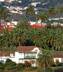
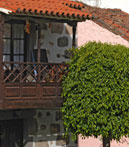
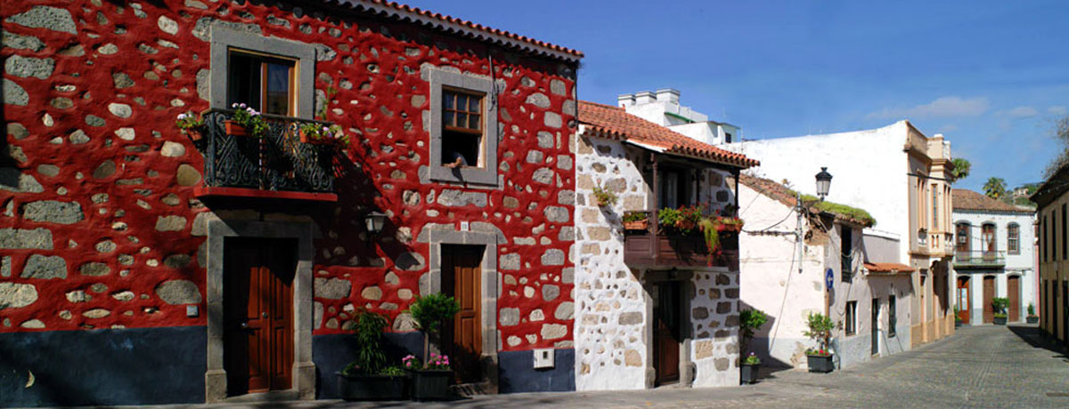
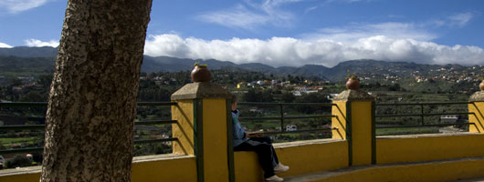
Villa de Santa Brígida is one of the municipalities of Gran Canaria with the greatest variety of scenery, and, above all, an enormous variety of flora. In fact, the town itself is set on the edge of a ravine, with lovely palm groves, which explains its pre-Hispanic name of Sataute.
Nowadays, Santa Brígida is a mixture of its farming past and its residential present, as this a target area for those seeking a sumptuous house outside of the big city of Las Palmas. This has been helped by the fertility of these lands, where almost all the local place names are a reference to the large extensions of native plants that existed here in the past: Monte Lentiscal, Los Olivos, Madroñal, Pino Santo...
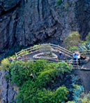
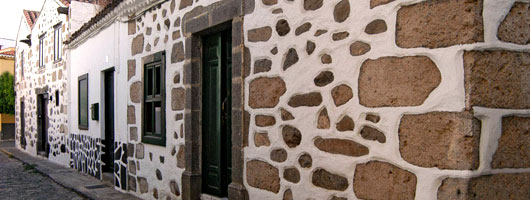
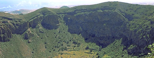
The area of La Atalaya is an old potters’ settlement of houses dug into caves, which still maintains its pottery tradition, despite its development. Close by is the golf course and the Caldera de Bandama, a volcanic crater measuring 1 km across. The best view of the crater is to be had from the look-out of the same name, at an altitude of 574 m, from where you can also catch a glimpse of Las Vegas, Las Palmas and the municipality of Telde.
Nowadays, farming has become secondary, as there has been an increase in the municipality, of built-up areas that has led to a decline in agriculture.
Trade and tourism, along with the development of these built-up areas have propitiated this change in the local economy.
Wine growing in Santa Brígida however, continues to maintain its excellent reputation on the island.