Moya celebrates a series of festivities, the most relevant of which is the Romería en Honor a San Antonio, which is held on the closest Saturday to the 13th June.
Other popular celebrations of the municipality are the Fiesta de la Virgen de Candelaria, the patron of the Villa de Moya, which takes place on the 2nd February.
In Fontanales, the inhabitants also celebrate the Fiestas en Honor a San Bartolomé the Apostle, who is invoked to protect the soil. Since the XVIIth century, Fontanales has celebrated this festivity and people from everywhere on the island meet here on the 24th August every year to join in the Romería.
The feast of San Judás Tadeo, the co-patron of the municipality, is celebrated in October.
After the conquest of Gran Canaria in the late fifteenth century, an important economic development took place relating to agriculture and more especially to crops that could be exported such as sugar cane. This development led, among other things, to the birth of urban settlements such as the Villa de Moya.

The first settlement grew up around the primitive shrine of Nuestra Señora de la Candelaria, most of the settlers being farmers.
In the mid-seventeenth century there was an increase in the population of the Medianías due to a revival in the production of sugar cane. It is at this time that the main centres of the area were created such as Fontanales, Barranco del Pinar, Trujillo, Los Dragos o El Laurel.
The quality of the soil, which favours agriculture, gave rise to an increase in trade in the municipality providing both for the Gran Canaria market and the market of Tenerife to which the north of the island had easy access. So Moya became one of the most populated areas of the north due to the economic expansion of its agriculture.
In the eighteenth century, Moya had a population which settled mainly in the Medianías, an area where both agriculture and stockbreeding were of great importance. During the nineteenth century, the population also spread to the Bosque de Doramas, leading to its disappearance as a natural area.
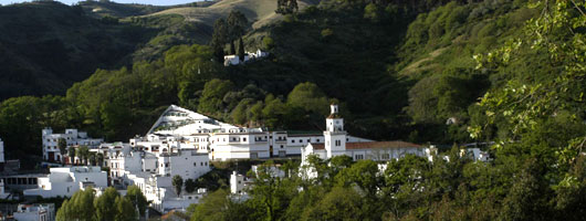
The Villa de Moya is situated in the north of Gran Canaria and the municipality extends over an area of 31.87 square kilometres. The centre of the village itself stands at 490 metres above sea level. The southern part of the municipality stretches almost to the peaks of the island in the area of Los Moriscos, which is 1.771 metres high, where it borders on the municipalities of Gáldar, Valleseco, Artenara and Tejeda.
Moya borders on the west with the municipality of Santa María de Guía across the ravine which has a series of different names at different points. This is why the names "Los Propios" and "Barranco del Laurel", make up the Barranco de Moya (the Moya ravine).To the east, it is limited by the Barranco de Azuaje which comes from Valleseco continuing through Firgas as far as Arucas. Set among these ravines and a series of hills running down to the coast stands Moya in a rugged landscape severed by deep gullies.
Among the peaks in the municipality of Moya are two of the most recent volcanoes of Gran Canaria: El Montañón Negroand the Caldera de Los Pinos. Both were in eruption just over 3,000 years ago. The trade winds have a marked influence on the climate of the municipality: frequent rainfall on the Medianías (a name given in the Canary Islands to the zones between the coast and the higher areas) and on the peaks in contrast to the dryness of the coastal area.
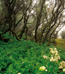
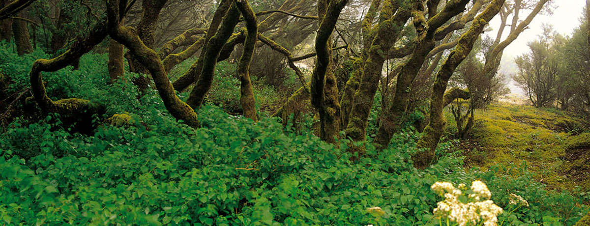
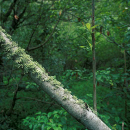
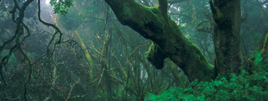
These climatic conditions have brought about an extensive area of Monteverde (green woodland including laurisilva and heather-myrtle) such as the Selva de Doramas, where we find Los Tiles de Moya. On the peaks there are extensive areas of pines. Generally speaking, Moya is a municipality in which there are cultivated crops in the lower zones such as bananas and subsistence crops in the Medianías and in the high areas.
The Villa de Moya has always been one of the municipalities of Gran Canaria with the greatest tradition of agriculture and stockbreeding
In the coastal area, mainly in Cabo Verde and Los Dragos, intensive agriculture for export is the predominant feature, with around 60 hectares of banana plantations.
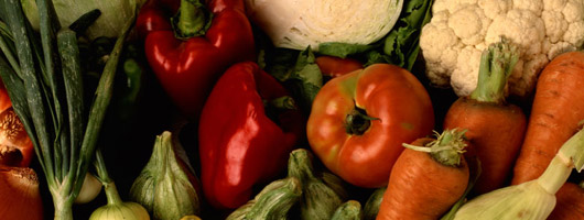
The Medianías are mainly made up of subsistence crops supplying the local market. The main crop is potatoes (79 hectares) which alternate with maize, beans, courgettes, carrots, lettuces etc. There are also 90 hectares of fruit trees, mostly lemon and orange trees. In the higher parts of the municipality (San Fernando and Fontanales) the agriculture is mostly potatoes and cereals.
Stockbreeding in this area focuses on the stabling of cattle and goats, the higher parts of the area being mainly dedicated to these activities.
Recently there has been a general decrease in agricultural activities following the abandonment of cultivated land. However, the base of the economy of Moya is still stockbreeding.
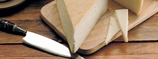
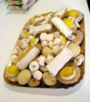
The production of cheese is now being promoted and there are at the moment 24 small cheese dairies producing a large variety of cheeses.
An addition to the economy has been the small industries such as that of the traditional and typical suspiros (meringues) and bizcochos de Moya (a kind of glazed biscuit in which the dough is baked twice), both of which are very sweet tasting