This site is known as La Redonda, and is the point at which the dividing lines between the municipalities of Moya, Santa María de Guía and Gáldar all converge, the highlight of which are the century old Canarian pines that give it its name. From this spot there are panoramic views of the whole of the north and west of Gran Canaria. The summit leads down to the middle hills with their mosaic patterned terrain where, to the north, human presence becomes that much more prevalent the further we move down to the coast.

These northern hills were the setting, in their day, for the legendary misty forests known as the Doramas Jungle (named so in memory of the indigenous leader who led the resistance against the Spanish Conquest of Gran Canaria).
Although valuable relics of the ancient jungle still remain, and are now expanding again, over a period of four centuries (from the end of the 15th to the end of the 19th century) most of it was cut down and the land used for subsistence farming and cattle rearing. Fruit trees, corn, potatoes and vegetables have been farmed here on small allotments, watered by the tradewinds, the life-giving breezes for the Doramas Jungle, which offload humidity before drying out as they pass over the peaks towards the south.

Wheat and barley crops abounded in their day at La Vega de Coruña as did pastureland for cattle in Galeotes and Pavón, indeed some farmers still bring their herds up through the hills to the summit through the summer into autumn. The royal pathway that takes them up there passes right by here, around the edge of the crater on its western side.


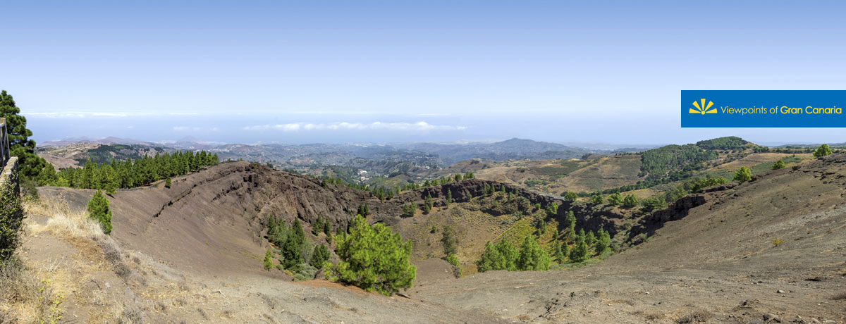
At our feet lies the la Caldera de los Pinos de Gáldar, a volcanic crater pertaining to the most recent volcanic cycle in the construction of Gran Canaria, as is the Montañón Negro volcano, situated to the east. They are twin peaks with an estimated age of 3.000 years.
The sun sets to the west behind the Pinar de Tamadaba montain, which walls off this corner of the island down into the sea, from Las Nieves to El Risco. Tirma stretches out to the south down to Aldea de San Nicolás.
This territory to the southwest of the island forms part of the World Reserve of the Gran Canaria Biosphere, as declared by UNESCO on 29th June 2005.


