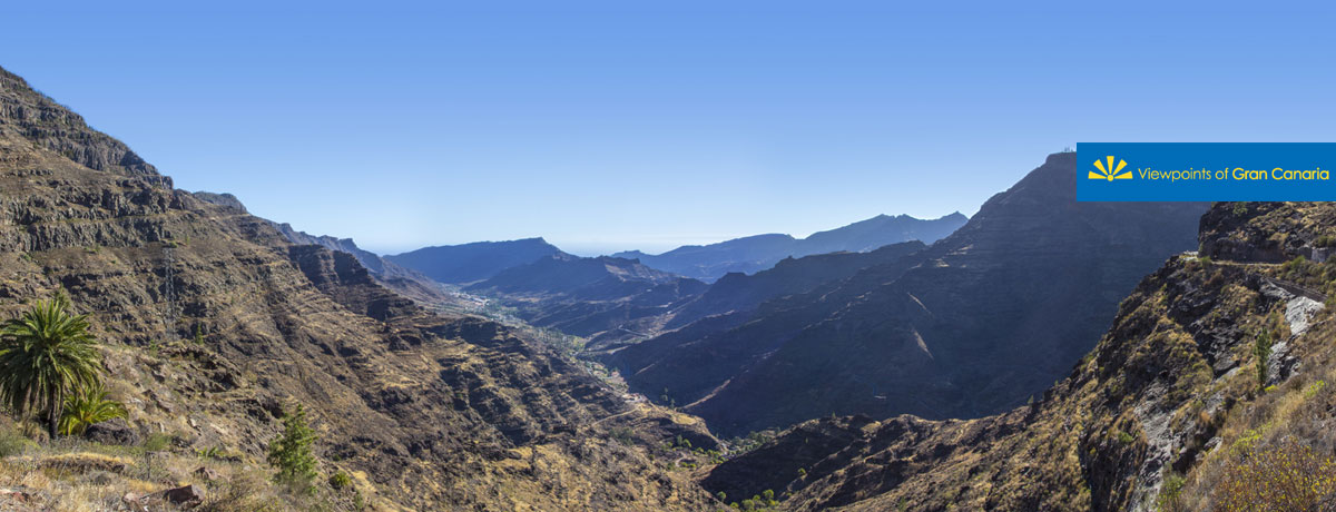
This viewpoint is situated right at the head of the Barranco de Mogán ravine. The montains that stand out are Tauro, Cruz de Mogán and Pinar de Ojeda. This whole territory forms part of Reserva Natural Integral de Inagua and the Nublo Rural Park, which stretches out from the centre of the island down to the sea.


It is a passing point from the south up to the north of the island, which the inhabitants from this region used to take as they made their way to the capital city, in the times before the present day roads were built.
Mogán used to form part of the municipality of Tejeda until 1815, when it constituted its own town hall. Many of the districts are located along the Barranco de Mogán itself, these being Pie de la Cuesta, La Vistilla, Las Casillas, El Cercado, Los Navarros, La Umbridilla, Lomo Quiebre and Puerto de Mogán.

The valley’s fertile soil and warm climate are ideal for the cultivation of tropical fruits such as citric fruits, papayas, mangos, avocados, etc. Cattle farming is another highly important primary sector in the region. The famous French anthropologist, René Verneau, described the area’s cattle farmers thus: “The Mogán shepherds can be considered the forerunners for Canary farmers... They always carried long poles... with this instrument they jumped from incredibly wide precipices and slid down to the bottom with lightning speed”. As for its traditional architecture, the houses have quite distinct roofs and there are a few old windmills and water mills.
This whole territory forms part of the World Biosphere Reserve of Gran Canaria, so declared by UNESCO on 29th June 2005.


